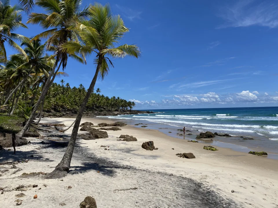
Third beach on the Passeio das 4 Praias, Camboinha lies beyond Havaizinho, after a 25-minute trail and some rocks at low tide. No facilities, but there are tide pools for snorkeling.
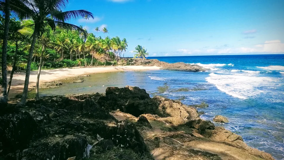
After the trail come the rocks. You step slowly, one at a time, with the sea breathing just a few meters away and the smell of salt rising from the wet stone. Then the rocks end and Camboinha opens up: a small cove of open sea, at the point where many people have already turned back. Most visitors never make it this far, and you can hear the difference in the silence.
The end of the road
Camboinha is the third beach on the Passeio das 4 Praias, between Havaizinho and Itacarezinho. Access is on foot only, along the Engenhoca and Havaizinho trail. From the highway it is about a 25-minute walk at an easy level, and Camboinha is about 10 minutes beyond Havaizinho.
The last stretch is what separates those who arrive from those who give up: a few more minutes over the rocks. For the same reason, the beach gets fewer people. Most never complete the four-beach trail.
The tide rules
Here, the timing of your visit decides everything. At low tide, the rocks are safe to cross and a coral barrier forms natural pools. At high tide, there are good waves, but crossing the rocks calls for extra care. There is only one piece of advice for getting here: go at low tide.
Check the tide table before setting out and plan your return, which crosses the same rocks.
A sea for looking
The sea at Camboinha is open and surrounded by rocks. The beach is better for contemplating and for snorkeling in the pools than for swimming. Those who go tend to highlight the feeling of having reached the end of the route and the peace of the place.
It is the smallest of the four beaches on the route, and there are no facilities at all: no restaurant, no kiosk. Bring water and everything you plan to consume. A curiosity for anyone searching for the name: the northern stretch of Itacarezinho is also called Camboinha.
Who it's for
For those who like to hike, to enjoy a beach without services, and to look for marine life in the pools with a snorkel mask. For those doing the four-beach route who want to go beyond Havaizinho. It is not the best choice for those looking for a sea to swim in, for those who need a kiosk nearby, or for those who have difficulty walking over rocks. At high tide, it is best to leave the visit for another day.
Practical info
- Getting there: by trail only, the Engenhoca and Havaizinho trail, followed by a few more minutes over the rocks.
- Trail: about 25 minutes from the highway, easy level, and about 10 minutes beyond Havaizinho; then the rocks at low tide.
- Distance from the center: about 12 km; 20 minutes by car plus 25 on the trail.
- Sea: open, with rocks; coral barrier with natural pools at low tide and good waves at high tide.
- Best time: low tide, to cross the rocks safely.
- Facilities: none, no restaurant or kiosk.
- What to bring: water, a snorkel mask and whatever you plan to eat.
- Safety: watch out for the rocks, especially at high tide.
Before you go
- Getting there
- Via the Engenhoca and Havaizinho trail, plus a few more minutes over the rocks (take care at high tide).
- Access by trail only; third beach on the Passeio das 4 Praias, between Havaizinho and Itacarezinho. Prefeitura de Itacaré
- Trail
- Engenhoca trail + 25 min, over the rocks at low tide
- 25 minutes from the highway, easy level; about 10 minutes beyond Havaizinho. Melhores Destinos (Guia de Destinos)
- Distance
- About 12 km from the center; 20 minutes by car plus 25 on the trail.
- Tides
- A coral barrier forms natural pools at low tide; at high tide there are good waves. Melhores Destinos (Guia de Destinos)
- Sea
- Open sea and rocks; better for contemplating and snorkeling in the pools than for swimming.
- Facilities
- None. Bring water.
- Smallest of the four beaches, with no restaurant or kiosk. Melhores Destinos (Guia de Destinos)
- Tips
- It gets fewer people because most do not complete the 4-beach trail. Melhores Destinos (Guia de Destinos)
- Good to know
- Because it lies at the end of the route, it is the beach almost no one reaches: go at low tide to cross the rocks safely.
- The northern stretch of Itacarezinho is also called Camboinha. Wikipédia (en)
Practical info
- Address
- Rod - BA-001 - Itacaré, BA, 45530-000, Brasil
- Opening hours
-
- Segunda-Feira Atendimento 24 horas
- Terça-Feira Atendimento 24 horas
- Quarta-Feira Atendimento 24 horas today
- Quinta-Feira Atendimento 24 horas
- Sexta-Feira Atendimento 24 horas
- Saturday Atendimento 24 horas
- Sunday Atendimento 24 horas
- Type
- beach
Location
Frequently asked questions
How do I get to Praia da Camboinha?
Only on foot, along the Engenhoca and Havaizinho trail, with a few more minutes over the rocks. The beach is about 12 km from the center: 20 minutes by car plus 25 on the trail.
What is the best tide to go?
Low tide, to cross the rocks safely. At low tide, the coral barrier also forms natural pools. At high tide, the stretch calls for care.
Can you swim at Camboinha?
The sea is open and surrounded by rocks. The beach is better for contemplating and for snorkeling in the pools than for swimming.
Is there a restaurant or kiosk on the beach?
No. The beach has no facilities at all. Bring water and whatever you plan to eat.
Do you manage this place? Correct details, send photos or request removal.